Products You May Like
It’s called climate change because it’s not just about hotter or drier, colder or wetter climate shifts. It’s about the increased and often unpredictable variability in the weather events that make up climate.
The remarkable climate stability of the past 10,000 years or so is a major driver of the growth and prosperity of human civilizations, but we are now headed into a very different world.
Understanding that new world is more important than ever for farmers, local leaders, air-traffic controllers, and the hundreds of other jobs that have trained for and depended on a predictable climate that is no more.
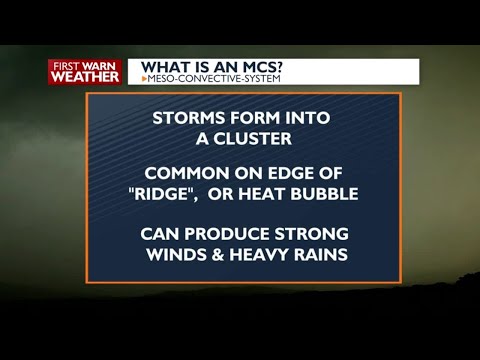
A perfect example: understanding how mesoscale convective systems, or MCSs, are intensifying as the planet warms.
MCSs are sprawling clusters of thunderstorms that can stretch across hundreds of kilometres and persist for hours. They produce more than half of tropical rainfall in some regions and are responsible for many intense rainstorms, including deluges that trigger devastating flash floods.
In a new study in Nature Geoscience, researchers in China and the US used a high-resolution climate model designed to represent these organized storms more realistically than conventional climate models can.
 frameborder=”0″ allow=”accelerometer; autoplay; clipboard-write; encrypted-media; gyroscope; picture-in-picture; web-share” referrerpolicy=”strict-origin-when-cross-origin” allowfullscreen>
They found that under a high climate-warming scenario, the seasonal cycle of rainfall produced by MCSs shifted dramatically: storms formed 10 to 15 days later and after that buildup, were about 38 to 45 percent more intense.
It’s unlikely those changes will come to pass; the rapid shift in our energy systems, which are increasingly powered by renewables instead of fossil fuels, has made the worst-case warming scenario used in simulations like these implausible.
But the findings serve as an important warning of climate-driven weather extremes, which can have a greater impact on the local people who experience them than overall tropical rainfall totals.
MSCs cause extreme and often deadly rainfall, wind, and flooding events.
“For instance, the 2020 MCS-driven Sahelian flood [in Africa] affected more than 2 million people, destroyed nearly 200,000 homes and caused 417 deaths across 18 countries,” the researchers write in the study.
In many tropical regions, the timing and intensity of the wet season determines water availability, agricultural timing (for planting and harvesting), and flood risk.
If more of the year’s rain arrives in a shorter, later window – and more of it arrives in intense storms – the consequences can be very different from simply getting a little more rain spread throughout the year.

Understanding how MCSs are affected by climate change could have “profound impacts”, according to the researchers, including life-or-death consequences.
“These results indicate that organized convection is a major pathway through which warming reshapes tropical rainfall seasonality, affecting the timing and intensity of hydroclimate risks,” they write.
In the study, the researchers divided the tropics into the Northern and Southern Tropics and ran paired 10-year simulations: one representing historical conditions and another using a high-warming scenario.
They looked at two measures of storm intensity: convective available potential energy (CAPE) and convective inhibition (CIN).
Maximum CAPE increased by about 35-40 percent, which indicates “a larger wet-season reservoir of convective energy”, and maximum CIN strengthened by about 90–130 percent, “indicating stronger inhibition that can favor more intense events once convection is triggered,” the researchers explain.
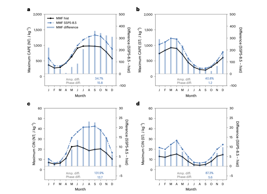
The reason for the changing rainfall season was put down to frequency: In the Northern Tropics, there were fewer MCSs early in the season, particularly before August.
That means the atmosphere’s increasing moisture doesn’t translate into as much rainfall as early in the season as it might otherwise.
Later in the season, however, the frequency changes are smaller, allowing that additional moisture to produce more rain once the wet season gets going.
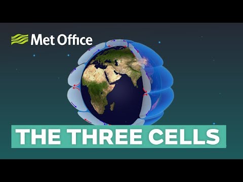
The researchers link this shift to the Hadley cells, the huge atmospheric circulation system that moves heat and moisture between the tropics and subtropics.
As the climate warms, the atmosphere develops greater effective heat capacity – in other words, it takes longer for it to respond to seasonal forcing.
 frameborder=”0″ allow=”accelerometer; autoplay; clipboard-write; encrypted-media; gyroscope; picture-in-picture; web-share” referrerpolicy=”strict-origin-when-cross-origin” allowfullscreen>
That increased “energetic inertia” slows the seasonal migration of the Hadley cells and delays the reversal of energy transport between the hemispheres. The ascending branch of the circulation therefore shifts later, pushing the rainfall peak later, too.
But when the rain does arrive, it packs more punch.
The researchers note that the same amount of annual rainfall can have very different consequences depending on whether it arrives in intense, organized storms or as weaker precipitation spread over a longer period.
This is important work because, as the study authors point out, most current forecasting relies on ‘coarse-resolution’ climate models that can’t adequately simulate MSC storm systems.
The new simulations here only look 10 years ahead because the high-resolution computer models used are so computationally intensive.
The researchers used a two-dimensional cloud-resolving model, which cannot capture every aspect of three-dimensional storms but adds exceptional realism to climate projections, making it a significant advance.
Related: ‘Tremendously Grave’: The First US City Is on Track to Run Out of Water
More simulations generated from different climate models using multiple warming scenarios are still needed to sharpen the regional picture.
The researchers also emphasize that the high-warming scenario they used should be viewed “as a high-warming sensitivity experiment” rather than a prediction of the most likely future.
Still, the study highlights something climate models have historically struggled to capture: the weather systems that actually deliver the rain.
As the planet warms, those systems may be rewriting not just how much rain the tropics receive, but when they get it, which could help humans plan a bit better for a changing world.
Read the full study in Nature Geoscience.
This article was fact-checked by Clare Watson and edited by Clare Watson. While we pride ourselves on our process, we are only human. If you spot a mistake, please let us know.