Products You May Like
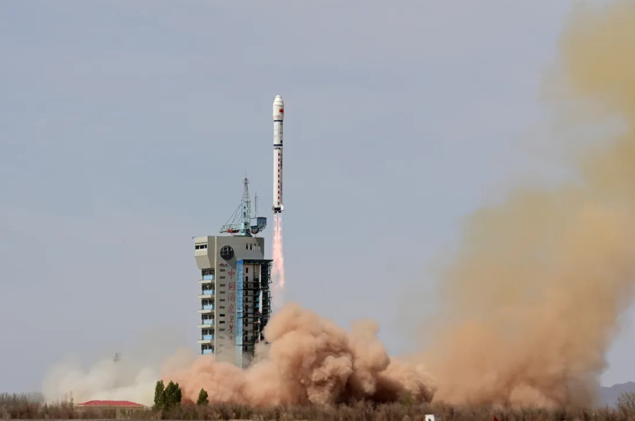
HELSINKI — China continued construction of a commercial constellation of remote sensing satellites early Monday with the launch of the SuperView-3 (01) satellite.
A Long March 2D rocket lifted off from Jiuquan Satellite Launch Center at 12:12 a.m. Eastern, April 15 (0412 UTC). The China Aerospace Science and Technology Corporation (CASC) confirmed launch success shortly after, revealing the payload to be SuperView-3 (01).
CASC described SuperView-3 (01) (also known as Gaojing-3 (01)) as China’s first commercial optical remote sensing satellite with an ultra-large width of more than 130 kilometers. The satellite is designed to provide 0.5-meter resolution and 9-band combined image data products.
The satellite will provide commercial remote sensing data services to support digital agriculture, urban modeling, and live 3D mapping, among other applications. Land surveying and disaster prevention and mitigation, and maritime monitoring purposes are also noted.
The SuperView, or Gaojing, satellites are part of a planned commercial remote sensing constellation. CASC, in its “blue book,” which outlines China’s space plans for 2024, stated it will continue work on a “four-dimensional new generation commercial remote sensing satellite system.”
This SuperView system, according to earlier statements, is to comprise at least 28 satellites. These include high-resolution optical payloads, wide-width optical payloads, high-resolution radar payloads and other diversified types of commercial remote sensing satellites.
It will also support the integration and value-added services of the Beidou GNSS system, and integrate satellite applications into emerging fields to support key regional economic development.
The first pairs of SuperView-1 satellites were launched in 2016 and 2018 respectively. A pair of SuperView-2 satellites were launched in 2022. All SuperView satellites have been sent into sun-synchronous orbits. The satellite operator is China Siwei Surveying and Mapping Technology Co., Ltd, a CASC subsidiary.
The commercial aspect is part of China’s broader strategy to enter and compete in the global market for satellite imagery.
China also has a commercial Earth observation firm in the shape of Changguang Satellite Technology (CGST). The Changchun-based remote sensing constellation operator is a well-backed spinoff from the Chinese Academy of Sciences’ CIOMP.
CGST has more than 100 Jilin-1 series satellites in orbit, including optical and video satellites, with panchromatic resolution of around 0.70 meters. In 2022 it expanded its plans to launch 300 satellites by 2025. This move followed the high-profile role of U.S. commercial satellite constellations in the Ukraine conflict.
The launch was China’s 16th orbital mission of 2024. The country is planning to launch around 100 times during the year, with CASC responsible for around 70 of these. Commercial actors are planning close to 30 launches.
Major launches in the coming weeks include the Shenzhou-18 crewed mission to the Tiangong space station early April 25. The Chang’e-6 lunar far side sample return mission is set to launch in early May.