Products You May Like
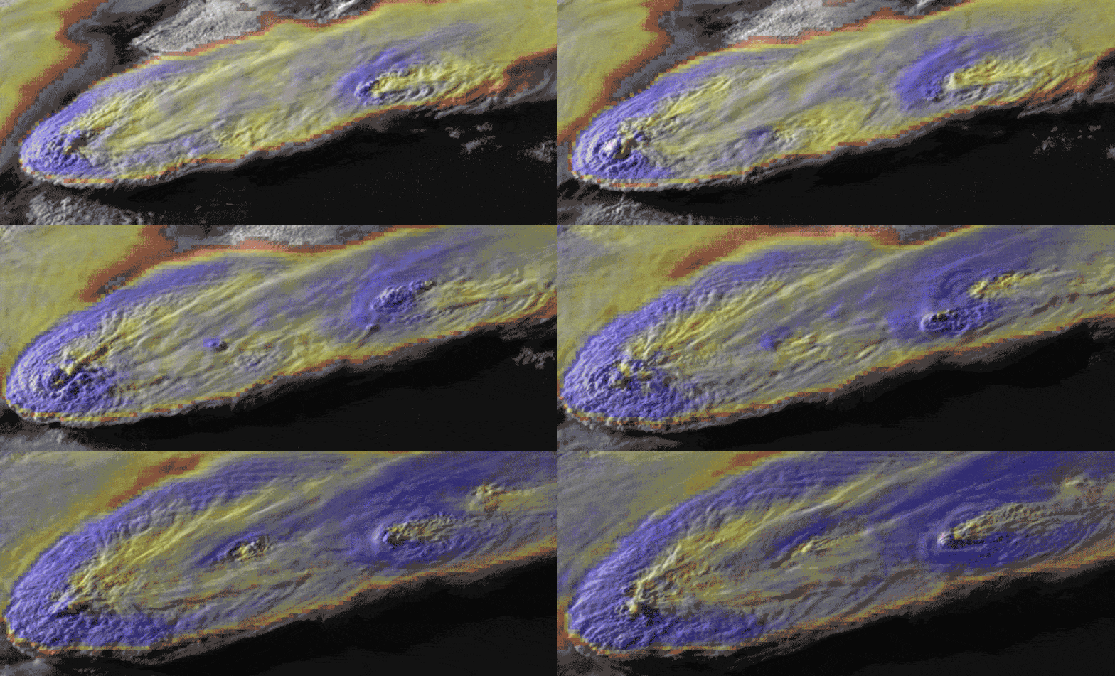
Something strange often happens just before a severe thunderstorm produces a tornado, high winds, or hailstones: A plume of ice and water known as an Above-Anvil Cirrus Plume (AACP) billows up above the top of the storm clouds and head downwind, acting as a sort of early warning system for extreme weather events.
For the first time, scientists think they’ve figured out what causes these cloudy plumes. What are known as hydraulic jumps – also seen when a waterfall crashes into the still water below creating a foamy cloud – are created as air rises above and then falls back into the thunderstorm clouds.
The researchers behind the new study say that their findings could give advance warnings to people on the ground about the risk of tornadoes, high winds, and hailstorms, particularly in places where existing Doppler radar system technology isn’t working or isn’t available to use.
“If there’s going to be a terrible hurricane, we can see it from space,” says atmospheric scientist Morgan O’Neill from Stanford University and the study’s lead author. “We can’t see tornadoes because they’re hidden below thunderstorm tops. We need to understand the tops better.”
O’Neill and her colleagues ran detailed simulations of supercell thunderstorms, the type of storms most likely to spawn tornadoes. In these fierce supercells, super-strong rotating updrafts push moist air higher than it would normally go in Earth’s atmosphere, through the top of the lower troposphere into the stratosphere.
The rising shoots of air – the AACPs – soon drop back to the troposphere, but the modeling showed a downslope windstorm at the border of the troposphere and the stratosphere, with wind speeds of up to 240 miles per hour (386 kilometers per hour) possible.
This frenetic turbulence produces hydraulic jumps, the scientists suggest, and those jumps are capable of injecting large amounts of water vapor into the stratosphere very quickly.
These jumps are also created by winds rushing down mountains and rocks, but they’ve never been seen before this high up in the atmosphere since the storm clouds are effectively acting as physical barriers.
“Dry air descending from the stratosphere and moist air rising from the troposphere join in this very narrow, crazy-fast jet,” says O’Neill. “The jet becomes unstable and the whole thing mixes and explodes in turbulence.”
“These speeds at the storm top have never been observed or hypothesized before.”
With NASA research aircraft now equipped with devices that allow them to map the winds at the top of thunderstorms in high-resolution 3D, the next step will be gathering real-world data to help corroborate what these models have shown.
About 75 percent of thunderstorms with these plumes produce large hail or tornadoes, so the research is likely to be useful in improving meteorological models in the future. Hurricane Ida recently left a trail of death and destruction across the northeastern United States, and a better understanding of these storms can save lives and property.
The study is also important in the broader picture of climate change, as these hydraulic jumps push large volumes of water into the typically very dry stratosphere. Over time, that’s going to have a long-term impact.
“In a warming climate that produces stronger and more intense convection, climate scientists are interested in how much water is injected into the stratosphere by thunderstorms because of the aggregate effect this has on stratospheric ozone,” says atmospheric scientist Leigh Orf from the University of Wisconsin-Madison.
“In our simulations that exhibit plumes, water reaches deep into the stratosphere where it possibly could have more of a long-term climate impact.”
The research has been published in Science.
